Friday, 31 October 2014

A Genuinely Scary Hallowe'en...

If you've ever enjoyed a night out trick-or-treating, spare a thought for the children of Arviat, Canada, who have been told to stay indoors this Hallowe'en. Why? It's all to do with the shrinking Arctic sea ice...click here to find out more. 


This image was captured in Arviat, Canada...a big clue as to why children
aren't allowed out this Hallowe'en. Source: www.slate.com


Thursday, 30 October 2014

A Polar Paradox?

According to the latest IPCC report, it is "very likely" that the extent of sea ice surrounding the Antarctic continent increased by 1.2 to 1.8% per decade between 1979 and 2012 (IPCC Fifth Assessment Report (AR5), 2013). That's equivalent to an additional 0.13 to 0.20 million square kilometres of ice each decade. 

Um, hang on...what?!

Didn't we spend last week discussing how Arctic sea ice is in DECLINE? Surely the Antarctic is warming up too, and if so, should be losing sea ice in the same way? This seems entirely contradictory and confusing...But fear not! While the trend in sea ice extent has been referred to as a 'puzzle' and 'enigma' in recent news reports, a number of possible explanations have been presented.


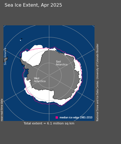
Antarctic sea ice extent (September 2014 average). The pink line shows the median
sea ice extent for September for the years 1981-2010. Sea ice extent hit a record
high on 22.09.14 at 20.11 million square kilometres. Source: www.nsidc.org
While counter-intuitive, it's important to realise that the increase in sea ice extent does not mean the Antarctic is cooling. Within the Southern Ocean, the Antarctic Circumpolar Current is increasing in temperature more quickly than the global average, and temperatures on the west coast of the Antarctic Peninsula have risen by almost 3°C within the last 50 years (NERC-BAS, 2014). But if the region is undergoing warming, how is it that more sea ice is forming?

The first thing to remember is that we are indeed talking about sea ice. This is simply - as the name suggests - ice formed through the freezing of sea water. In other words, reports you've heard about melting glaciers and collapsing ice shelves on Antarctica are correct - these are referring to land ice. 

Sea ice is formed through the freezing of sea water. It therefore does
not contribute to sea level change upon melting. Source: www.nsidc.org
Zhang (2007) suggests that a strengthening of ocean stratification may be responsible for the observed increase in sea ice production. Models which incorporate a rise in air temperature show decreasing levels of ice formation, which in turn lead to decreased salinity levels in surface waters (since salts are rejected during ice formation) (Zhang, 2007). A decrease in salinity reduces the density of the water, and heightens the thermohaline stratification of the water column. This lessens convective overturning and the upward heat flux, allowing for greater sea ice formation and reduced melt (Zhang, 2007). Other factors which decrease the salinity of surface waters - for example, increased precipitation or freshwater run-off from melting land ice - could bring about the same result (Earthsky, 2014). Freshwater also has a higher freezing point than salt water, further increasing ice production.

It should be mentioned at this point that sea ice increase is not observed everywhere in the Antarctic, with sea ice decline seen in some regions, for example the Bellingshausen and Amundsen seas (IPCC, 2013). However, the overall net change is positive, with the large amount of ice produced in the Ross Sea outweighing the loss elsewhere (IPCC, 2013). It is thought that changes in atmospheric and ocean circulation could be responsible for these effects. For example, strengthening winds can push ice away from the continent, creating coastal polynyas (ice-free areas) where more ice can then form. The exact cause of these changes is unknown, though they could be part of natural climate variability (NASA, 2014). Turner et al. (2009) suggest that loss of stratospheric ozone could be responsible. In their model, decreasing ozone led to the deepening of a low pressure system called the Amundsen Sea Low, which gave increased ice production in the Ross Sea (Turner et al., 2009).


A penguin having a little trouble in the strengthening winds...
Source: www.gdargaud.net

Increased snowfall is another explanation for the observed changes. Firstly, the weight of snow that falls directly onto the sea ice can force it beneath the ocean surface. This means sea water floods the ice, increasing its thickness when it subsequently freezes and produces 'snow ice' (IPCC, 2013). Secondly, it has been suggested that increased snowfall on the Antarctic landmass, while increasing ice thickness at the centre of the ice sheet, leads to loss of ice (in the form of ice bergs) at its margins (CBC News, 2014). A greater number of ice bergs leads to reduction in ocean movement, facilitating sea ice production (CBC News, 2014).


This is not an exhaustive account of the theories that have been put forward to explain the increase in sea ice around Antarctica. Indeed, it is likely to be a combination of these suggestions, or perhaps another mechanism entirely. Furthermore, owing to the remote location of this region, and a lack of historical data (satellite observations only began in 1979), there is still plenty to learn about this phenomenon. The observed increase in sea ice was not predicted by climate models, and it is possible that natural climate variability is responsible for the changes seen (IPCC, 2007; Turner et al., 2009) . This makes sea ice increase a contentious topic, as demonstrated by this (timely!) debate on Tuesday's Newsnight (see 33.48 onwards).   


Tuesday, 21 October 2014

See Ice Today, Sea Ice Tomorrow?

"Human influence on the climate system is clear. This is evident from the increasing greenhouse gas concentrations in the atmosphere, positive radiative forcing, observed warming, and understanding of the climate system." (IPCC Fifth Assessment Report (AR5), 2013).

We all know about climate change, right? It's an issue that has spread beyond the realm of the scientific community, and found its way into the public consciousness. Furthermore, I'm sure I'm not alone in feeling - as a member of the human race - more than a little guilty about it. In their Fifth Assessment Report (AR5), the Intergovernmental Panel on Climate Change (IPCC) deemed it "extremely likely that human influence has been the dominant cause of the observed warming since the mid-20th century", finding it "unequivocal that anthropogenic increases in the well-mixed greenhouse gases (WMGHGs) have substantially enhanced the greenhouse effect". If climate change is 1) anthropogenic in origin and 2) impacting upon the polar regions, then it's definitely something we need to address here. So, how are the polar systems responding to climate change, and are the observed consequences similar in the Arctic and Antarctic?

Ask a child why they should turn off the lights, and they might reply "to save the polar bears". On the face of it, that seems a pretty big leap of logic...but we all understand what they mean. The fact that the polar bear has become the archetype of species under threat from climate change suggests that there's something not too good happening up there in the north...The map below begins to explain why:


Global map showing trends in mean surface air temperature between 1960 and 2011. The inset graph shows the relationship between temperature change and latitude. Source: https://nsidc.org. Credit: NASA GISS.
As can be seen here, large areas of the Arctic have been warming at a rate greater than 2°C over the last half century (NSIDC, 2014). This means that over recent decades the Arctic has been the most rapidly warming area on Earth. As a consequence of this, significant negative trends in sea ice extent have been recorded. The following statistics were published in the IPCC Fifth Assessment Report (AR5), 2013:


  • Between 1979 and 2012 sea ice extent (defined by the IPCC as "the sum of the ice covered areas with concentrations of at least 15%") declined by ~3.1 - 4.1% per decade, which is equivalent to 0.45 - 0.51 million square kilometres per decade.
  • Perennial ice (ice which has lasted for at least one summer, and found by measuring the summer minimum extent) decreased from 7.9 million square kilometres in 1980 to 3.5 million square kilometres in 2012, with an 11.5±2.1% decline per decade. Furthermore, multi-year ice (ice which has lasted for at least two summers) decreased even more rapidly, by 13.5±2.5% per decade. 
  • Owing to the decline in older ice types (see previous bullet point), average ice thickness decreased by 1.2 metres between 1980 and 2000. 
  • As a result of thinner ice, the drift speed of sea ice has increased. Transport of multi-year ice into the southern Beaufort Sea accounted for over a third of older sea ice loss between 2005 and 2008.

That's probably enough numbers for now - you get the idea. If you're interested in sea ice decline, the National Snow and Ice Data Center website posts a daily image of current Arctic sea ice extent. Also, this video shows the decline of sea ice in 2012, when its extent hit a record low: 


These statistics are all very well, but what really matters is what they mean. I've set out to gain a balanced scientific understanding of how mankind is impacting upon the polar regions, rather than wishing to sound too sensationalist. But I must admit, most of what I've read is pretty gloomy. Reduced sea ice has a number of consequences, not least, loss of habitat. In other words (or rather, a picture) this:


As promised, a polar bear picture. Here showing how sea ice reduction will alter the Arctic habitat. Source: www.polarbearsinternational.org
Other repercussions are rising sea levels, greater variation in ocean salinity throughout the year, changing species distributions, and increased risk for indigenous populations (Rodger, 2009). We'll take a more detailed look at some of these later on. Before I finish, however, one more important point must be made. Sea ice has a high albedo; this simply means that it is highly reflective, and therefore capable of returning large amounts of radiation to space. Water has a significantly lower albedo, absorbing heat rather than reflecting it. Therefore, as sea ice declines (and melt period lengthens), the albedo of the Arctic decreases, leading to a positive feedback loop of warming. The Arctic currently acts to cool the rest of the planet, meaning changes to this region will have far-reaching consequences (NSIDC, 2014). Indeed, one study suggests that a scenario where the Arctic is ice free for one month in the summer (with a reduced amount of ice throughout the year), would lead to a global radiative forcing of 0.3 Wm-2 (Hudson, 2011).

I wanted to begin by taking a look at Arctic sea ice decline, because this in itself has facilitated many of the other ways in which humanity is impacting upon this region. Next we'll take a look at the Antarctic, because surely climate change is causing loss of sea ice here too? 


Thursday, 16 October 2014

A Continent of Extremes

It's looking pretty Autumnal outside, which is basically a nice way of saying it looks drizzly, misty and grey. Mind you, I actually quite like it when the nights begin to draw in, and I can't think of a better time to sit here with a cup of tea, and tell you about the Antarctic.


The Antarctic

Although the Antarctic Circle is positioned at 66°33'44'' S, the Antarctic is often thought of as the area south of 60° S, with islands in this region (including the ominously named Deception Island) referred to as Antarctic islands. Antarctica itself was discovered in 1820, and holds the record for being the coldest, driest and highest continent on the planet.


Map of Antarctica. Source: www.geology.com

During the winter months, more than half of the Southern Ocean freezes over, with ice extending 2000 kilometres away from Antarctica's coastline. During the spring melt, almost two-thirds of this ice disappears, and the majority of the Antarctic Peninsula finds itself stretching out into ice-free waters (Fothergill & Berlowitz, 2011). 

Just as it can be difficult to comprehend the staggeringly long time scales over which geological events take place, it can be hard to imagine the sheer scale of some of Antarctica's features; the vastness of this landscape is simply astonishing. A 3200 kilometre chain of peaks - the Transantarctic Mountains - divides the continent into West Antarctica and East Antarctica, and interestingly it is this formation that is responsible for keeping Antarctica's Dry Valleys clear of ice. If you were to visit the region you could see these mountains, looming over the landscape. (Just as an aside, I would not recommend this - firstly, it is one of the most hostile environments on Earth, and secondly, I don't want to encourage Antarctic tourism, for reasons we will discuss on a separate occasion). But there is another notable mountain range - the 1200 kilometre long Gamburtsev Range - that you would not see, however cloudless the sky. How so? Because its peaks are buried beneath 600 metres of snow and ice; in other words, it is underneath the East Antarctic Ice Sheet. 

With a maximum depth of 4776 metres and covering an area of nearly 14 million square kilometres, the Antarctic ice cap is the greatest ice mass on Earth (NERC-BAS, 2014). You can begin to see what I mean about the scale...In fact, 90% of the planet's fresh water is found here. The East Antarctic Ice Sheet (home of the South Pole) is markedly the larger of the two, and lies on a large continental land mass. In contrast, the West Antarctic Ice Sheet is referred to as 'marine-based', with some parts resting more than 2500 metres below sea-level. Where the ice sheets meet the ocean they form ice shelves, and from these, ice bergs are created.

There's plenty more I could tell you about this extraordinary continent, but I should probably end there for now...We'll find out more over the coming weeks as we explore the impact of mankind on this region. Perhaps I should finish by explaining, as promised, why you might want to re-think a trip to the East Antarctic Plateau (I know you were tempted). The current temperature at the South Pole is -53.7°C - pretty cold (NERC-BAS, 2014). But this is positively balmy compared to the coldest temperature ever recorded on Earth, which is -89.2°C, a measurement taken in 1983 at the Russian research station Vostok, on the East Antarctic Ice Sheet (Turner et al., 2009). Furthermore, satellite data indicate that temperatures in this region could be even lower, with a reading of -93.2°C taken in August 2010 (NASA, 2013). While this can't be an official record (owing to the way in which it was measured), it gives you an idea of how extreme this continent is, and of how much we still have to learn about it.



Sunday, 12 October 2014

A Very Brief Introduction to...

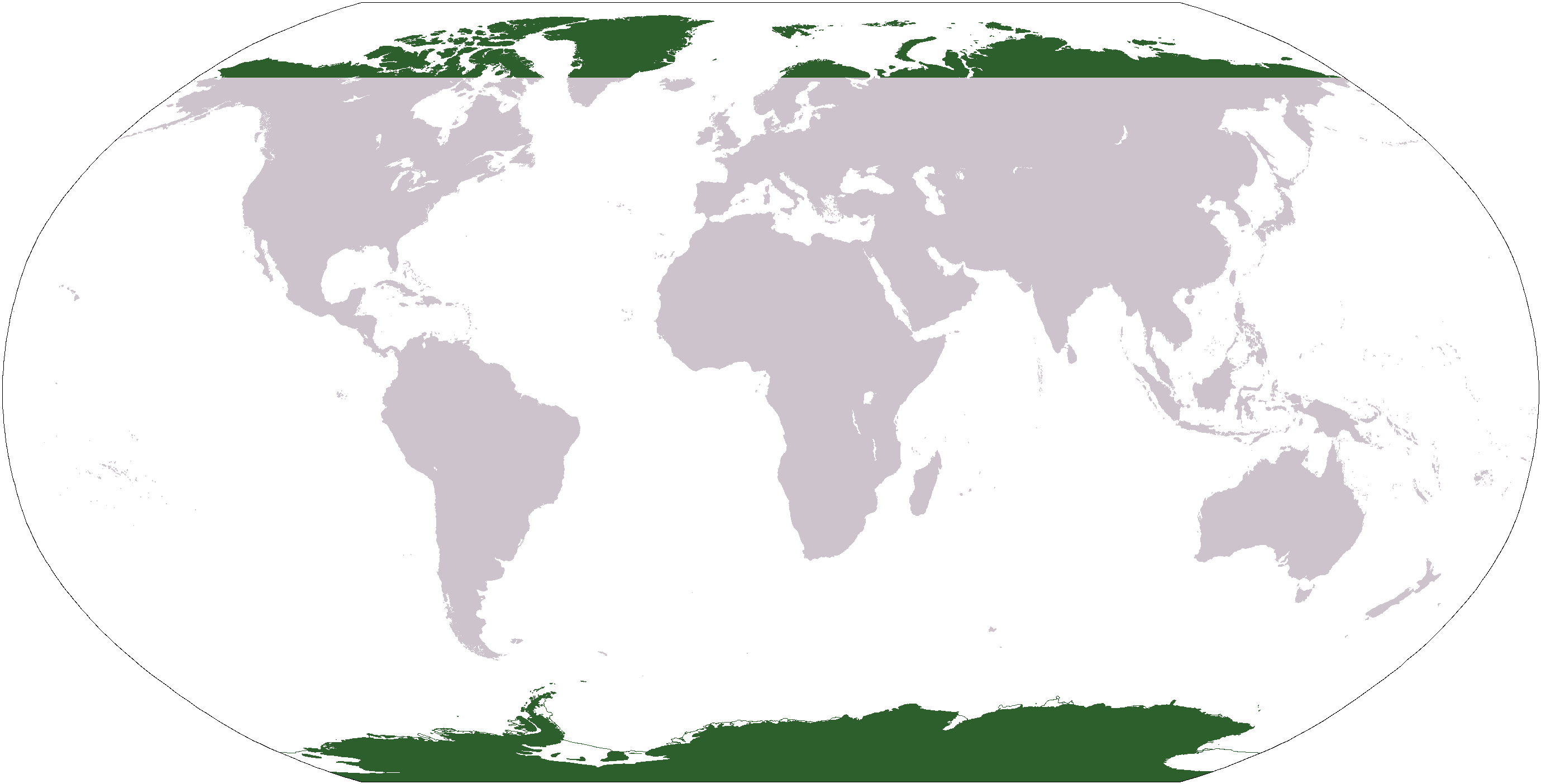
It quite frankly seems more than a little irresponsible to begin any sort of expedition - theoretical or otherwise - without so much as a map to guide you. So here is my very brief introduction to the polar regions, beginning with the Arctic...

Source: www.commons.wikimedia.org


The Arctic

About three weeks ago, on the 22nd September, my MSc in Climate Change officially began. A day later, the UN Climate Summit 2014 took place in New York. And while these things were happening, the sun set at the North Pole, to remain below the horizon for six months. I find that an incredible thought. 

It can be difficult to define exactly what is meant by 'The Arctic', since different people have alternative ideas regarding exactly where its southern boundary lies. For some, it is the tree line that forms the start of the taiga forest, while for others it is defined by the ten degree isotherm (the line that marks where the average temperature of the warmest month - July - does not reach above 10°C) (Fothergill & Berlowitz, 2011). Here we will define the Arctic as the region north of the Arctic Circle, which circumnavigates the globe at 66°33'44'' N. This is the area where the sun remains above or below the horizon on the summer or winter solstice, respectively. The diagram below shows the different ways in which the Arctic can be defined:

Map of the Arctic showing the Arctic Circle (dotted blue line), the tree line (green line) and the ten degree isotherm (red line). Source: https://nsidc.org   
Unlike at the South Pole, there is no land mass at the Geographic North Pole, which is located at 90°N in the middle of the Arctic Ocean. Depending on the season, this ocean is covered by a varying amount of pack ice, which can be up to 8 metres thick (Fothergill & Berlowitz, 2011). At its maximum, almost 85% of the ocean is concealed beneath virtually 14 million square kilometres of sea ice (Fothergill & Berlowitz, 2011). The nearest land, the northern tip of Greenland, lies approximately 725 kilometres from the North Pole, but parts of Asia, Europe and North America all extend within the Arctic Circle (Fothergill & Berlowitz, 2011).

That ends my very brief introduction to the Arctic...next we'll take a look at the opposite end of the globe, and learn why - if you're already dreading the cold winter weather - you should probably never consider a trip to the East Antarctic Plateau...


Friday, 10 October 2014

Of (Not So) Distant Lands?

Roald Amundsen described Antarctica as 'like a fairytale', while Philip Pullman turned the Arctic into one, with his stories of armoured bears roaming a frozen north. Indeed, it is easy to romanticise the poles, lands of midnight sun or endless night, frozen deserts at the very edges of the Earth. Surely the number of past explorers who have tried - many failing - to reach these regions is testament to the intrigue they hold. Yet despite their distance from us, they are not beyond the reach of mankind, and despite their vastness and apparent invincibility, they are far from being immune to the actions of humanity. In fact, the polar regions are amongst the most rapidly changing on Earth, with the consequences of climate change already visible here. One example of this is the increase in summer ice melt observed on the Antarctic Peninsula (Abram et al., 2013)

I have long been fascinated by the poles, and through this blog - started as part of my MSc in Climate Change - I hope to explore the impact that mankind is having on these regions, and examine the science behind it. This is a huge field of research, but over the coming weeks I aim to examine each of the main threats currently facing these high-latitude regions, including climate change, exploitation of resources, and pollution, specifically comparing and contrasting the ways in which they are effecting the Arctic and Antarctica. In relation to climate change, I will look at the changes which have already occurred, in addition to those predicted for the future.  


I welcome any comments you have, and look forward to sharing what I find with you. I will now leave you with a video taken from the documentary 'Chasing Ice', showing a calving event in the Ilulissat Glacier, Greenland...beautiful and scary, I shan't say any more. 


Oh, and for those of you who only navigated here to find cute pictures of polar bears, I promise there'll be some of those along the way too!